| |
|
|
|
|
| |
Pre D-Day attacks on the German radars on the Channel
coast. |
|
|
|
|
|
|
|
Home |
|
|
|
|
|
|
|
The subject has always fascinated me, and recently I
came into possession of some ADI (Science) files that describe the
planning in detail. It is perhaps well known, that the Allies
conducted an operation consisting of a number of attacks on German radar
sites on the Channel coast. It was my belief, that the main
purpose was to deprive the Germans of early warning of the approaching
invasion fleet, but this is far from the case, the main purpose was to
deny the Germans a recognized air picture and the ability to perform
close control of nightfighters (Himmelbett), no doubt to ease the plight
of the airborne landings. Every Flugmeldemess Stellung
("GCI-site") from Calais to Cherbourg was targeted, whereas multiple sea
surveillance radar sites were ignored as were the Jägerleit Stellungen,
which performed Y-Verfahren of day- and nightfighters. For sure some
sea surveillance radars were spared so they could detect the spoof
operations
TAXABLE and GLIMMER. If one defines "The assault area" as the
coastline with the five landing beaches, it is certainly true, as stated
in some sources, that two or more radarstations were attacked outside
the area than inside the area. |
|
|
|
As early as in March 1942 Lft.3 had ordered that all
Würzburg in the Flugmeldemess Stellung should be employed for sea
surveillance, when they were not required for fighter control. So
neutralizing the W-Rs would serve a dual porpose. |
|
|
|
|
|
|
|
Based on an ULTRA message kindly provided by Nick
Beale, it seems as if the fleet was never detected by radar, but only
acquired visually at dawn break. This however is contradicted by a
statement by a POW from DIESTELFINK. |
|
|
|
|
|
|
|
In order to attack the radar sites, they first had to be
located. So a chain of ELINT stations called Ping Pong were set up
on the southern coast of England. Some sources say only three
stations, other just state a chain. Since the stations could D/F
with an accuracy of 1/4 of a degree, and since they were widely spaced,
they provided for fairly accurate fixing. E.g. at 90 NM less than
1/2 NM. This was more than accurate enough to task a photo recce
flight, and eventually nearly all radar site positions were fixed,
photographed and the types of radars identified. In one source it
is mentioned that the Ping Pong covered 390 - 1550 Mhz. This
cannot be correct since many early warning and some sea surveillance
radars operated at around 125 Mhz. |
|
|
|
|
|
|
|
Map of D-Day operations. |
|
|
|
.jpg) |
|
|
|
|
|
|
|
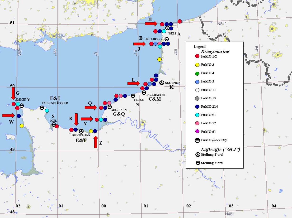
Spread sheet describing the targets. The capital letters are the
serials contained in the original ADI document. Please also see map
below. |
|
|
|
|
|
| |
 |
|
|
|
|
|
|
|
Two German views. |
|
|
|
|
|
|
|
.JPG) |
|
|
|
|
|
|
|
.jpg) |
|
|
|
|
|
|
|
This indicates to me that more sites were attacked
than those on the original target list. |
|
| |
|
|
|
|
|
|
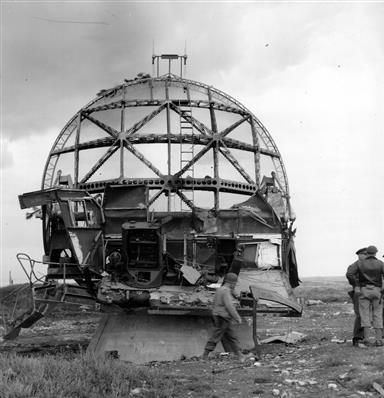
and some results. |
|
|
|
|
|
|
|
|
|
%20(Small).jpg) |
|
 |
|
|
|
Serial F,
Tausenfüssler |
|
Serial R, Arromanches |
|
|
|
|
|
|
|
|
|
.JPG) |
|
.jpg) |
|
|
|
Serial Z, Houlgate. |
|
Serial E, DIESTELFINK. |
|
|
|
|
|
|
|
|
|
|
|
| |
|
|
| |
|
|
| |
 |
|
| |
|
|
|
|
| |
Home |
|
| |
|
|
|
|
| |
|
|
|
|